
Also called as Kattalgad (In Marathi, “Kattal” -> Death. “Gad” -> Fort) as this was used by the Britishers to execute prisoners of war.
Base Village: Tupewadi, Vasole (30km from Wai).
- The place shown on the Google Map for “Tupewadi” is incorrect. The correct place of this village are at coordinates: 17.989175, 73.740900; Actual location of Tupewadi
How to reach: One can take his/her own vehicle and park at the base. The villagers are really nice people and you can safely park your vehicle. There are following two routes to reach Tupewadi –
- Route#1 ==> Pune-Khed Shivapur-Khandala ghat-Wai-Menawli road-Tupewadi. You can get these directions through the Google map easily.
- Route#2 ==> Pune-Khed Shivapur-Bhor phata-Bhor-Kamalgad&Raireshwar Plateau-Jambhali road-Vasole-Tupewadi. The directions are given in the link below:
Pune to Tupewadi via bhor
If you are going on a bike, I would strongly suggest taking Route#2 as this is one of the most scenic routes, especially in Monsoons and post-Monsoons. Why I say this, you will get to know in my detail blog below.
One can also reach Tupewadi by public transport as the village is well connected to the nearby town of Wai by the State Transport buses. You can board the bus to Wai from Swargate bus stand, Pune with the first direct bus at 7 am and from Wai you can catch the bus to Tupewadi. The last bus reaches Tupewadi at around 7:30 pm which stays there overnight and leaves the village at 6 am the next morning. On reaching back to Wai, you can board bus to Mumbai and Pune at every 30 minutes with first bus at 6 am.
Trek Grade: Easy.
Best season: Anytime of the year as the route is covered with trees even in summers.
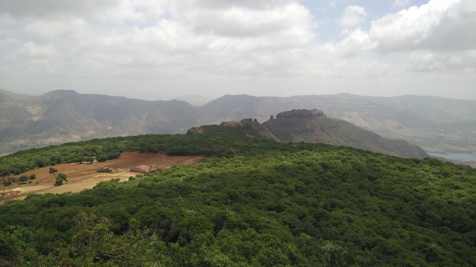
Attraction: A Beautiful village of Tupewadi with warm hearted people; a huge man-made well with steps carved out; A temple of Gorakhshnath; View of other peaks such as Kenjalgad, Rajgad, Raireshwar, Padavgad, Mahabaleshwar and Panchgani range along with the scenic view of Dhom Back Waters.
Food Availability: You can make food arrangement at base village. At the top, there is small habitat where a shepherd family lives. You can ask the family to make food arrangements for you while you visit ballekilla (main fort).
Water and Stay Availability: Water is available at the base village and at shepherd’s house at the top.
Mobile range: You receive range for BSNL and Dolphin. You get the range for Vodafone and Airtel somewhere at the middle of the climb.
Safety Tips:
– One has to take a minimum amount of safety during every trek, not just this one.
– Climbing is very safe, however, one must take care of directions.
– No ropes required.
We started off from Pune at around 4 pm in our private car. We took NH4 going towards Satara and took right at Bhor phata and took Route#2 as described above. On the way, we came across a beautiful architecture of Jijisaheb’s Suspension Bridge.
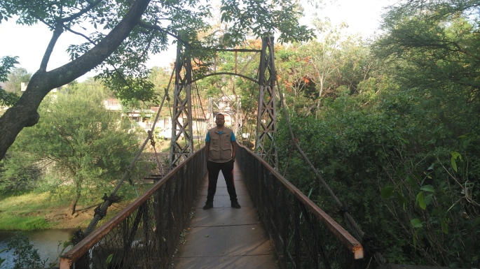
This bridge is said to be made in 1936 AD by Maharaj of Bhor in the memory of his mother Jijisaheb. This bridge connects the main road to the Nageshwar temple.


Following images show the beautiful stream that flows under the suspension bridge.


After this, you head towards the Kenjalgad-Raireshwar road. On this route, you go very close to Kenjalgad.
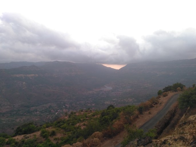
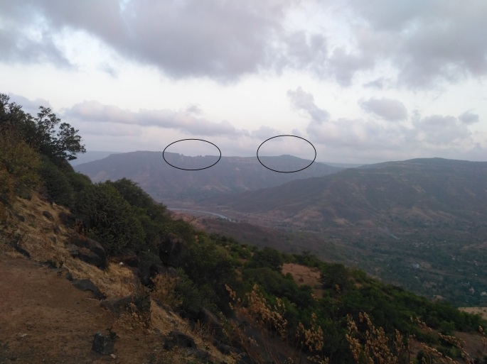
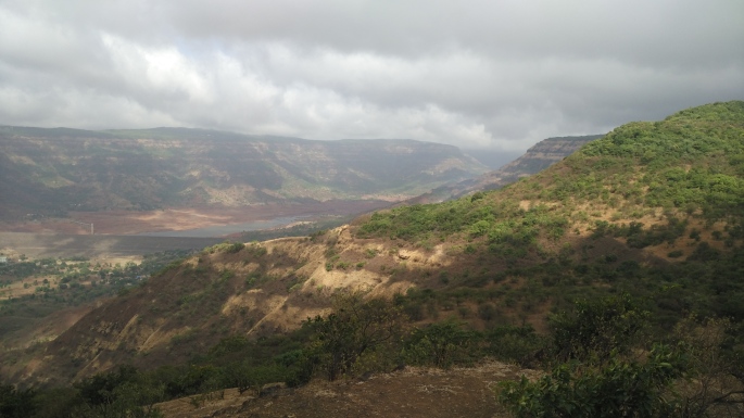
This route crosses a col which links Kenjalgad and Raireshwar to the left and to the right respectively. On crossing this col (A col is the lowest point of a ridge or saddle between two peaks, typically providing a pass from one side of a mountain range to another), you can view beautiful Mahabaleshwar-Panchgani range. We saw with clouds hovering over the range making the scene really beautiful.
From this location, you can get the first glimpse of Kamalgad and to its right, you will see “Sitecha Palna” (In English: Swing of Sita).
Other images captured along the route:


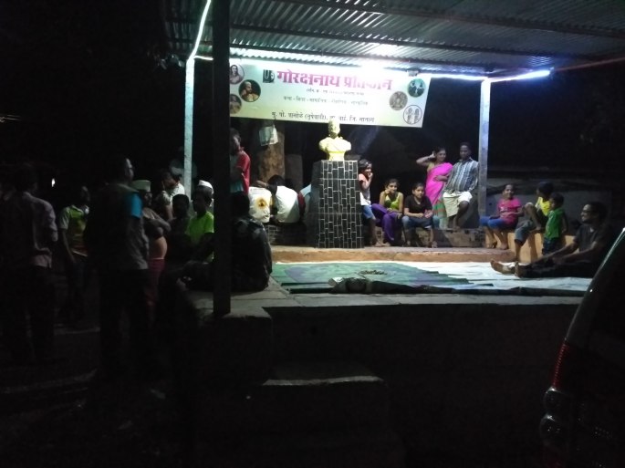
After traversing through the magnificent Route#2, we reached Tupewadi by around 7:30 pm. It is a really a small and nice village surrounded with mountains and step farms. To top it all, villagers there really make this trip memorable. We started conversing with them and in no time we were part of them. They offered us with farm fresh groundnuts, jackfruit which were really yummy..!!!
The village has a chaupal where they gather in the evening, have chit-chat and all masti.
Our original idea was to start climbing at night and have a glimpse of Sunrise. However, villagers suggested us to not to climb at night as the routes are very deceptive and one can get lost very easily. Respecting their views, we stayed at the village and decided to start the trek early in the morning.
It was a windy night which was completely opposite to what we were used to in Pune and hence, we did not take our proper bedding. But totally opposite of what we anticipated, we were literally shivering with cold and there we saw what selfless help really mean. Villagers came to the rescue and offered us with their own blankets. A true spirit of humanity…!!! That is the reason why I will always love to be there again and again..!! 🙂
Next morning, we had tea and started the trek. The atmosphere was such that we thought it would rain at anytime. It was cold, windy with black clouds hovering over. We got a beautiful glimpse of colourful flora on the way.
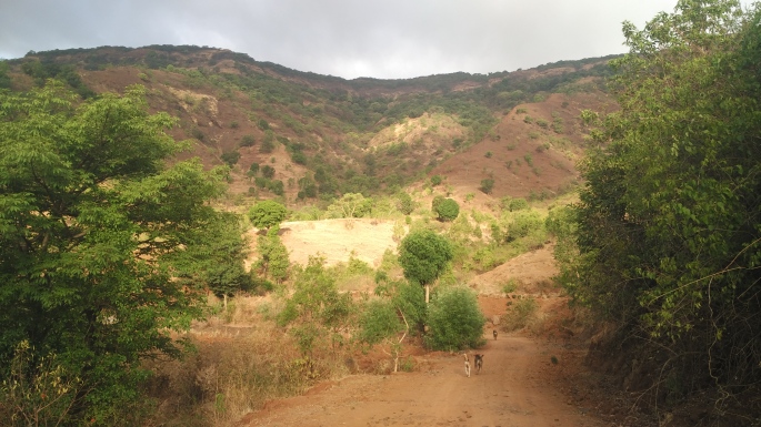
The route was very scenic and covered with trees, so even if you trek in hot summer, it won’t affect much.


On the way, you find Mango trees in numbers along with Karvanda (karonda) and Jambhul (Indian Blackberry). I spent majority of time plucking Karvandas from the shrubs and feasting over them.


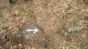 After about 1:30 hrs of a climb, you reach a plateau from where you need to take left towards the fort. On the way, you will find arrows painted in white. So look for these carefully.
We also encountered a pugmark which meant that some animal might have crossed the way just before we reached the spot. Remember, you go through a reserve forest and there are leopards and wild boar in the area.
Few meters ahead, you reach another summit from where you can view the Mahabaleshwar and Panchgani range.

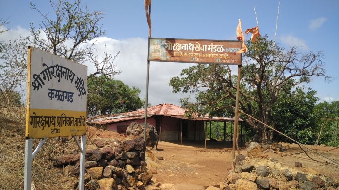
Few meters ahead, you come across Gorakshanath Temple. If you trek at night, you can stay here.
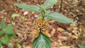
Moving ahead, you cross the jungle. I got an interesting shrub of Kachkoiri with a unique design that can be seen characteristically in this region.
After traversing through the jungle, you reach another plateau where you see farm belonging to shepherd family living there.
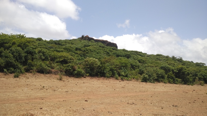
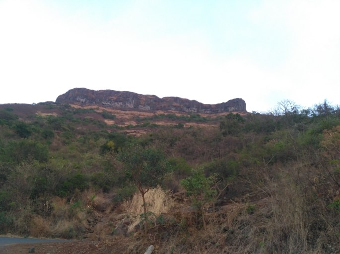
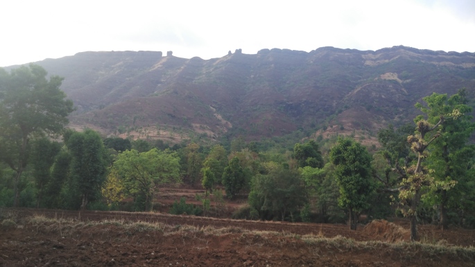
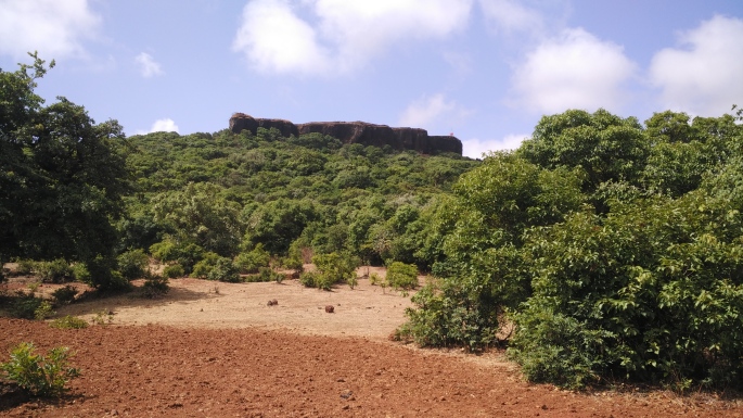
To the right side of the plateau you will see the main fort (balekilla) of Kamalgad.
Moving forward you will reach shepherd’s hut where you can ask for food and tea arrangements. There onwards, take the right to go to main fort. The path from here is again covered with a jungle.
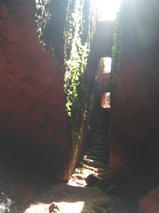
At the entrance of the fort, you will find a steel ladder between huge boulders from where you reach the top.


Once you reach the top, the view of the area is simply mind-blowing. It feels as if there is a bed with green cover and we can just plunge into it…!!!
At the top, you will find a man-made well that is carved out of the rock. It is said that this well was used to execute the prisoners of war by the Britishers. The prisoners had the option of either die of drowning into the well or die of starvation.
You will find a staircase going into the well. The well remains dry throughout the year except in monsoon.


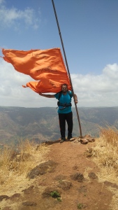
A few meters away from this well, you come to the end point of the fort marked with a saffron flag. It is really windy here and I had to literally hold the flag mast to be stable at this point.
From this point, we started our return trek back to Tupewadi thus completing yet another exciting trek.
I hope you like the above post and I would love to know your suggestions, advice, comments related to this article.
Stay tuned for more blogs on more exciting treks and related articles. Till then HAPPY TREKKING …!!! 🙂 🙂

Very well – written. Looks like a memorable experience. Keep it up!
LikeLiked by 1 person
Thanx Indraneel…happy that u liked the post 🙂
LikeLike
It’s really a excellent narration.you took me along yourself on the trek virtually. Thanks. Satish Joshi
LikeLiked by 1 person
Thank you so much Satishji. Happy to learn you liked the blog. Hope to see u in real time in my future treks. 🙂 Happy trekking … !!!
LikeLike